Capacity Model Inputs
The requisite inputs to the capacity model include:
- A drainage network layer and associated hydrography
- Vegetation type raster data
- Digital Elevation Model (DEM)
- Streamflow (baseflow and peak flow) information throughout drainage network
Existing, readily and freely available datasets from GIS data clearinghouses can be used as model inputs. Just make sure all input data are projected in the same coordinate system prior to running the BRAT model.
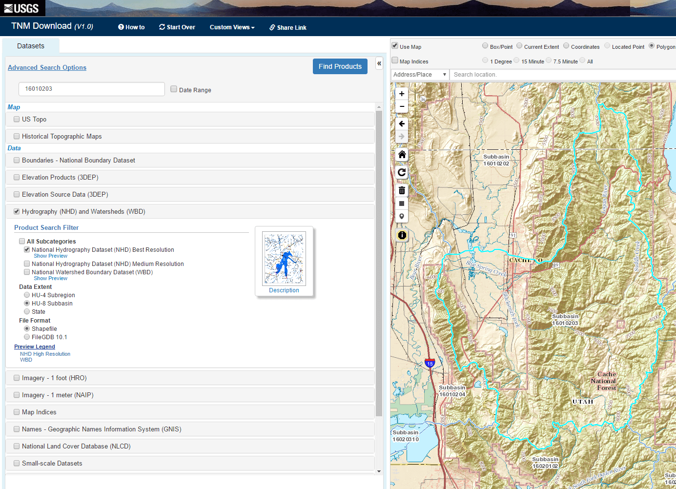
Drainage Network
We use the National Hydrograph Dataset (NHD) for the drainage network and associated hydrography data. The NHD layers required to run BRAT include the stream flowline, waterbody and area feature classes.
Vegetation Raster
You will need 2 separate vegetation rasters:
- Existing vegetation raster
- Historic vegetation raster
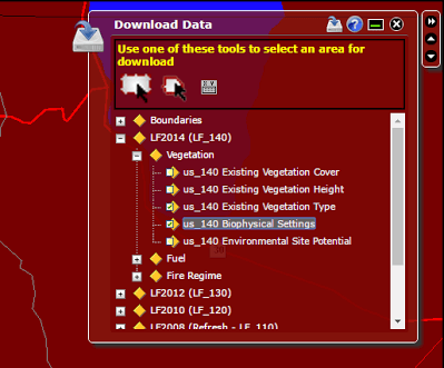
We typically use Landfire for the vegetation raster inputs. If using Landfire, download:
- ‘us_200evt’ (existing vegetation type)
- ‘us_200bps’ (historic vegetation type)
Note: If ‘us_200’ is not yet available for your study area you can use ‘us_140’.
Note: The historic vegetation layer (biophysical settings, bps) represents the vegetation that may have been dominant on the landscape prior to Euro-American settlement and is based on both the current biophysical environment and an approximation of the historical disturbance regime.
If you are interested in creating your own vegetation raster you will need to make sure all your data points are polygons, and converted into a raster. If possible check to see if any of the LANDFIRE data already has what you are looking for. If you are not mapping all of the vegetation, you will need to merge your vegetation data with the LANDFIRE data. The model will not properly if there are vegetation gaps within your study area. In order for the program to work properly, you will need to add a ‘VEG_CODE’ field to your vegetation input raster. If you are running the entire BRAT model you will also need a land use raster with specific additional fields coded. We tend to use the LANDFIRE EVT raster as out land use raster.
Note: While LANDFIRE data is a good source for existing and historic vegetation in the USA other datasets can be used where LANDFIRE is not available.
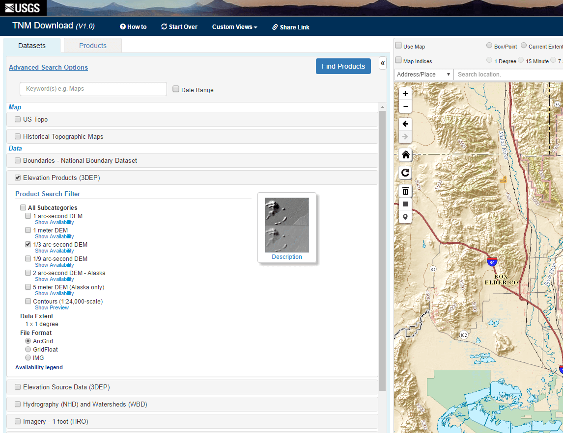
DEM
We typically use USGS National Elevation Dataset (NED) 1/3 arc second (~ 10 m) DEM data.
Streamflow Information
If you need base and high flow estimations for your stream network, regional regression equations can be found at USGS StreamStats or USGS National Streamflow Statistics.
- Baseflow regional regression equations (e.g. PQ80 for month with lowest flows)
- Highflow regional regression equations (e.g. Q2 - 2 year recurrence interval peak flow)
Optional Constraints and Opportunities Model Inputs
The requisite inputs to the Constraints and Opportunities Model include:
- Approximation of the valley bottom
- Detailed roads layer
- Railroads layer
- Canals layer
- Landuse raster
Valley Bottom Layer
The valley bottom is a polygon feature class. We use it to check if roads or railroads are in the valley bottom as they may have a higher probability of being flooded or impacted by nearby beaver dam building activity. The Valley Bottom Extraction Tool (V-BET) is what we typically use to derive this.
Roads Layer
We use TIGER roads shapefile for the roads layer input. Use ‘All Roads’ shapefiles which are downloaded by county.
Railroads Layer
The national railroads shapefile can by downloaded here.
Canals
Canals can be extracted from the NHD Flowline layer (our recommended drainage network dataset) using the ‘FCODE’ attribute field. Canals have ‘FCODE’ 33600, 33601, and 33603.
Land Use Raster
If no accurate land use layer exits for you study are you can use the Landfire existing vegetation type raster (e.g., ‘us_140evt’).
Optional Strategy Mapping Inputs
The requisite inputs for the optional beaver dam management strategy map include:
- Conservation protection areas
- Locations of surveyed beaver dams
- Conservation easement areas (optional)
Conservation Protection Areas Layer
The conservation protection areas layer is a polygon feature class representing areas that protect and conserve wildlife from harvest. For federal-level protected areas, see the BLM NLCS dataset and NPS boundaries. Ideally, additional state and local data would also be used.
Beaver Dams Layer
The beaver dams layer is a points feature class holding locations of surveyed beaver dams. These could be based on ground surveys or remote surveys where trained technicians identify beaver dams and lodges from aerial imagery.
Conservation Easements Layer (Optional)
The conservation easements layer is a polygon feature class representing land protected under conservation easements. These areas will be treated as equivalent to protected areas in the strategies.
Optional Validation Inputs
Surveyed beaver dam locations are required for the model validation. These data can be collected either via field data or surveys of aerial imagery.
 Back to BRAT Home